


Voting Districts not defined, Macomb County, Michigan
About
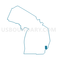
Outline

Summary
| Unique Area Identifier | 598087 |
| Name | Voting Districts not defined |
| County | Macomb County |
| State | Michigan |
| Area (square miles) | 86.51 |
| Land Area (square miles) | 0.02 |
| Water Area (square miles) | 86.49 |
| % of Land Area | 0.02 |
| % of Water Area | 99.98 |
| Latitude of the Internal Point | 42.59727550 |
| Longtitude of the Internal Point | -82.78931180 |
Maps


Graphs
Select a template below for downloading or customizing gragh for Voting Districts not defined, Macomb County, Michigan


Neighbors
Neighoring Voting District (by Name) Neighboring Voting District on the Map
- Voting District 0991534000003, Macomb County, MI
- Voting District 0991534000008, Macomb County, MI
- Voting District 0991534000010, Macomb County, MI
- Voting District 0991534000020, Macomb County, MI
- Voting District 0993682000001, Macomb County, MI
- Voting District 0993682000002, Macomb County, MI
- Voting District 0993682000003, Macomb County, MI
- Voting District 0993682000004, Macomb County, MI
- Voting District 0993682000005, Macomb County, MI
- Voting District 0993682000009, Macomb County, MI
- Voting District 0993682000012, Macomb County, MI
- Voting District 0994434000001, Macomb County, MI
- Voting District 0995710000001, Macomb County, MI
- Voting District 0995710000004, Macomb County, MI
- Voting District 0997076000001, Macomb County, MI
- Voting District 0997076000012, Macomb County, MI
- Voting District 0997076000026, Macomb County, MI
- Voting District 1633542000003, Wayne County, MI
- Voting District 1633550000002, Wayne County, MI
- Voting District 09936820, Macomb County, MI
- Voting District 0993682000010, Macomb County, MI
- Voting District 0995710000Null, Macomb County, MI
- Voting District 0997076000009, Macomb County, MI
- Voting District 0997076000013, Macomb County, MI
- Voting District 0997076000017, Macomb County, MI
- Voting District 0997076000021, Macomb County, MI
- Voting District 0997076000022, Macomb County, MI
- Voting District 0997076000023, Macomb County, MI
- Voting Districts not defined, St. Clair County, MI
- Voting Districts not defined, Wayne County, MI
Top 10 Neighboring County Subdivision (by Population) Neighboring County Subdivision on the Map
- St. Clair Shores city, Macomb County, MI (59,715)
- Chesterfield township, Macomb County, MI (43,381)
- Harrison charter township, Macomb County, MI (24,587)
- New Baltimore city, Macomb County, MI (12,084)
- Clay township, St. Clair County, MI (9,066)
- Ira township, St. Clair County, MI (5,178)
- Village of Grosse Pointe Shores city, Wayne County, MI (2,929)
- Village of Grosse Pointe Shores city, Macomb County, MI (79)
- County subdivisions not defined, Macomb County, MI (0)
Top 10 Neighboring Place (by Population) Neighboring Place on the Map
- St. Clair Shores city, MI (59,715)
- New Baltimore city, MI (12,084)
- Village of Grosse Pointe Shores city, MI (3,008)
Top 10 Neighboring Unified School District (by Population) Neighboring Unified School District on the Map
- L'Anse Creuse Public Schools, MI (68,985)
- Grosse Pointe Public Schools, MI (51,055)
- Anchor Bay School District, MI (34,890)
- Lake Shore Public Schools, MI (22,551)
- South Lake Schools, MI (20,058)
- Lakeview Public Schools, MI (19,626)
- Algonac Community School District, MI (15,197)
- School District Not Defined (Water), MI (243)
Top 10 Neighboring State Legislative District Lower Chamber (by Population) Neighboring State Legislative District Lower Chamber on the Map
- State House District 32, MI (103,394)
- State House District 81, MI (95,883)
- State House District 24, MI (84,381)
- State House District 1, MI (83,897)
Top 10 Neighboring State Legislative District Upper Chamber (by Population) Neighboring State Legislative District Upper Chamber on the Map
- State Senate District 11, MI (313,398)
- State Senate District 25, MI (251,359)
- State Senate District 9, MI (249,029)
- State Senate District 2, MI (196,435)
- State Senate District 1, MI (190,372)
Top 10 Neighboring 111th Congressional District (by Population) Neighboring 111th Congressional District on the Map
- Congressional District 10, MI (719,712)
- Congressional District 12, MI (636,601)
- Congressional District 13, MI (519,570)
Top 10 Neighboring Census Tract (by Population) Neighboring Census Tract on the Map
- Census Tract 2200.01, Macomb County, MI (7,544)
- Census Tract 2473, Macomb County, MI (6,365)
- Census Tract 2476.02, Macomb County, MI (4,625)
- Census Tract 2200.02, Macomb County, MI (4,540)
- Census Tract 2682, Macomb County, MI (3,922)
- Census Tract 2225, Macomb County, MI (3,699)
- Census Tract 2512, Macomb County, MI (3,379)
- Census Tract 2228, Macomb County, MI (3,214)
- Census Tract 2516, Macomb County, MI (3,092)
- Census Tract 6470, St. Clair County, MI (3,085)
Top 10 Neighboring 5-Digit ZIP Code Tabulation Area (by Population) Neighboring 5-Digit ZIP Code Tabulation Area on the Map
- 48047, MI (39,415)
- 48236, MI (30,607)
- 48045, MI (24,604)
- 48080, MI (22,494)
- 48081, MI (20,635)
- 48082, MI (16,549)